Current hours: 10am to 5pm Tuesday through Saturday. We are closed Sundays and Mondays until late May. Proud to be a SMALL, LOCAL, CAPE COD BUSINESS! Maps of Antiquity is in its 38th year! Our maps are only available at our website www.mapsofantiquity.com or at our store!

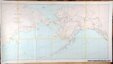
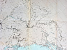
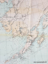
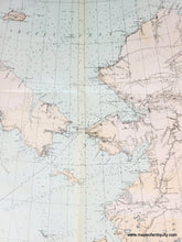
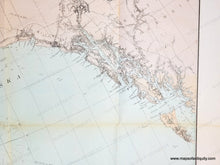
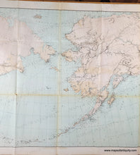
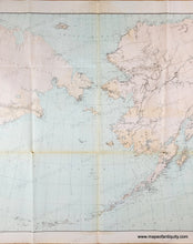
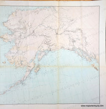
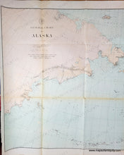
Antique map with original printed color in light pink-tan for the land and light blue for the water showing Alaska and part of Asia. Genuine-Antique-Map-General-Chart-of-Alaska-1890-USC-GS-Maps-Of-Antiquity
  • Load image into Gallery viewer, Antique map with original printed color in light pink-tan for the land and light blue for the water showing Alaska and part of Asia. Genuine-Antique-Map-General-Chart-of-Alaska-1890-USC-GS-Maps-Of-Antiquity
  • Load image into Gallery viewer, Antique map with original printed color in light pink-tan for the land and light blue for the water showing Alaska and part of Asia. Genuine-Antique-Map-General-Chart-of-Alaska-1890-USC-GS-Maps-Of-Antiquity
  • Load image into Gallery viewer, Antique map with original printed color in light pink-tan for the land and light blue for the water showing Alaska and part of Asia. Genuine-Antique-Map-General-Chart-of-Alaska-1890-USC-GS-Maps-Of-Antiquity
  • Load image into Gallery viewer, Antique map with original printed color in light pink-tan for the land and light blue for the water showing Alaska and part of Asia. Genuine-Antique-Map-General-Chart-of-Alaska-1890-USC-GS-Maps-Of-Antiquity
  • Load image into Gallery viewer, Antique map with original printed color in light pink-tan for the land and light blue for the water showing Alaska and part of Asia. Genuine-Antique-Map-General-Chart-of-Alaska-1890-USC-GS-Maps-Of-Antiquity
  • Load image into Gallery viewer, Antique map with original printed color in light pink-tan for the land and light blue for the water showing Alaska and part of Asia. Genuine-Antique-Map-General-Chart-of-Alaska-1890-USC-GS-Maps-Of-Antiquity
  • Load image into Gallery viewer, Antique map with original printed color in light pink-tan for the land and light blue for the water showing Alaska and part of Asia. Genuine-Antique-Map-General-Chart-of-Alaska-1890-USC-GS-Maps-Of-Antiquity
  • Load image into Gallery viewer, Antique map with original printed color in light pink-tan for the land and light blue for the water showing Alaska and part of Asia. Genuine-Antique-Map-General-Chart-of-Alaska-1890-USC-GS-Maps-Of-Antiquity
  • Load image into Gallery viewer, Antique map with original printed color in light pink-tan for the land and light blue for the water showing Alaska and part of Asia. Genuine-Antique-Map-General-Chart-of-Alaska-1890-USC-GS-Maps-Of-Antiquity
  • Load image into Gallery viewer, Antique map with original printed color in light pink-tan for the land and light blue for the water showing Alaska and part of Asia. Genuine-Antique-Map-General-Chart-of-Alaska-1890-USC-GS-Maps-Of-Antiquity

1890 - General Chart of Alaska - Antique Map

Regular price
$250.00
Sale price
$250.00
Regular price
Sold out
Unit price
per 
Shipping calculated at checkout.

Item number: WES551
Genuine Antique Map

1890

Maker: USC&GS

Antique map of Alaska with the coast of Siberian Russia, by the US Coast and Geodetic Survey, 1890. Original printed-color. Includes detailed topographic information, navigational information such as soundings, and towns and forts. Very good antique condition with folds as issued, a few minor spots, and some tiny separations at the fold intersections. Approx. 25.75 x 48.5 inches to the neatline.

Genuine Antique Map from 1890

Item Number: WES551