Winter hours: Tuesday - Saturday 10am to 5pm. Close Sundays and Mondays until May. We appreciate your business!

Antique-nautical-chart-map-West-Indies-Caribbean-South-Coast-of-Cuba-Guantanamo-Bay-US-Dept-Navy-1900-Maps-of-Antiquity
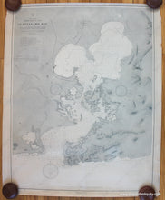
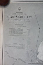
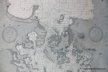
1900 - West Indies South Coast of Cuba Guantanamo Bay - Antique Chart
  • Load image into Gallery viewer, Antique-nautical-chart-map-West-Indies-Caribbean-South-Coast-of-Cuba-Guantanamo-Bay-US-Dept-Navy-1900-Maps-of-Antiquity
  • Load image into Gallery viewer, 1900 - West Indies South Coast of Cuba Guantanamo Bay - Antique Chart
  • Load image into Gallery viewer, 1900 - West Indies South Coast of Cuba Guantanamo Bay - Antique Chart

1900 - West Indies South Coast of Cuba Guantanamo Bay - Antique Chart

Regular price
$350.00
Sale price
$350.00
Regular price
Sold out
Unit price
per 
Shipping calculated at checkout.

Item number: NAU317
Genuine Antique Nautical Chart

1900

Maker: US Dept of the Navy.

Antique nautical chart of Guantanamo Bay in Cuba by the US Dept of the Navy, published 1900. With soundings, and information on tides, light houses, buoys, tides, and more. Very good overall condition with toning and some roughing of the paper edges. Approx. 38.5 x 30 inches to the neatline.

Item Number: NAU317