Winter hours: Tuesday - Saturday 10am to 5pm. Close Sundays and Mondays until May. We appreciate your business!

Antique-printed-color-Map-West-of-the-Mississippi-United-States--1879-Wheeler-Maps-Of-Antiquity
1879 - West of the Mississippi - Antique Map
  • Load image into Gallery viewer, Antique-printed-color-Map-West-of-the-Mississippi-United-States--1879-Wheeler-Maps-Of-Antiquity
  • Load image into Gallery viewer, 1879 - West of the Mississippi - Antique Map
  • Load image into Gallery viewer, 1879 - West of the Mississippi - Antique Map
  • Load image into Gallery viewer, 1879 - West of the Mississippi - Antique Map
  • Load image into Gallery viewer, 1879 - West of the Mississippi - Antique Map

1879 - West of the Mississippi - Antique Map

Regular price
$450.00
Sale price
$450.00
Regular price
Sold out
Unit price
per 
Shipping calculated at checkout.

Item number: WES175
Genuine Antique printed color Map

1879

Maker: Wheeler.

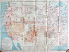
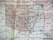
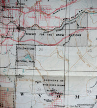
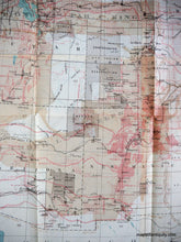
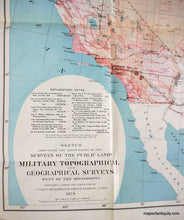
From Lt. George M. Wheeler of the U.S. Army Corps of Engineers, 1879, his "Sketch Indicating the Advancement of the Surveys of the Public Lands and the Military, Topographical and Geographical Surveys West of the Mississippi", its many notations of Indian tribes, reservations and territories serving as a graphic reminder of the diverse numbers of Native American peoples who once flourished across the nation; also shown are U.S. Army forts and camps; land grants; the routes of early military expeditions; the advancement of the railroad into the interior; and the nation's, and some say the world's, first national park, Yellowstone, opened in 1872. Very good overall antique condition with original folds, with a few tiny tears at some fold corners, measures 32.5 x 44.5 inches, folded measures 11 x 8.5 inches.

Item Number: WES175