Current hours: 10am to 5pm Monday through Saturday. Closed on Sundays. PLEASE NOTE: Our maps are only available at our website www.mapsofantiquity.com or at our store!

Genuine-Antique-Wall-Map-Untitled-(Geographical-Publishing-Company's-World-Wall-Map)-1930-Geographical-Publishing-Company-Maps-Of-Antiquity
  • Load image into Gallery viewer, Genuine-Antique-Wall-Map-Untitled-(Geographical-Publishing-Company's-World-Wall-Map)-1930-Geographical-Publishing-Company-Maps-Of-Antiquity
  • Load image into Gallery viewer, Genuine-Antique-Wall-Map-Untitled-(Geographical-Publishing-Company's-World-Wall-Map)-1930-Geographical-Publishing-Company-Maps-Of-Antiquity
  • Load image into Gallery viewer, Genuine-Antique-Wall-Map-Untitled-(Geographical-Publishing-Company's-World-Wall-Map)-1930-Geographical-Publishing-Company-Maps-Of-Antiquity
  • Load image into Gallery viewer, Genuine-Antique-Wall-Map-Untitled-(Geographical-Publishing-Company's-World-Wall-Map)-1930-Geographical-Publishing-Company-Maps-Of-Antiquity
  • Load image into Gallery viewer, Genuine-Antique-Wall-Map-Untitled-(Geographical-Publishing-Company's-World-Wall-Map)-1930-Geographical-Publishing-Company-Maps-Of-Antiquity

1930 - Untitled (Geographical Publishing Company's World Wall Map) - Antique Map

Regular price
$125.00
Sale price
$125.00
Regular price
Sold out
Unit price
per 
Shipping calculated at checkout.

Item number: WOR373
Genuine Antique Wall Map

1930

Maker: Geographical Publishing Company


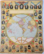
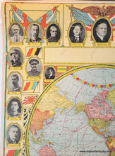
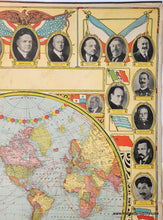
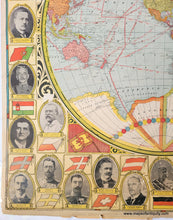
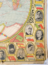
Antique printed color wall map, c. 1930, by the Geographical Publishing Company. This interesting map features a border comprised of the photographs of world leaders along with their title and flag. The map shows time zones, distances, expeditions to the North and South poles, and much more. Colored by country. The title area was left blank on this map, and there are other similar examples without a title. Notable figures include King George V, President Herbert Hoover, Emperor Hirohito of Japan, General Von Hindenberg of Germany, Benito Mussolini of Italy, and strangely Ivan Stalin "New Soviet Emperor" along with Alexis Rykoff President of Russian Soviet. There is another similar map that was published slightly earlier and has Michael (a minor) as king of Roumania (hist first rule was 1927-1930) and Prince Regent of Japan along with Takeji Nara General of Japan. There is another map on the back side of this sheet: A larger version of NAM252 a pictorial map of North America designed by The Geographical Publishing Co. and published in an atlas in 1944. With illustrations indicating the major industries of the area, such as agriculture, lumbering, mining, education, meat packing, and more. On original hanging rod. Poor condition with tears and damage at the edges, especially the bottom edge. This map could be restored and backed for about $150 but one of the sides would be  hidden under the backing. Measures approx. 34 x 27 inches to the border lines.


Item Number: WOR373