All About Nautical Charts
We have noticed a lot of interest in nautical charts lately, and thought it would be interesting for everyone if we put together some information about nautical charts and other nautical items.

1775 - An Exact Chart of the River St. Lawrence from Fort Frontenac to the Island of Anticosti shewing the Soundings, Rocks, Shoals, &c. by Thomas Jeffreys
Nautical charts called portolan charts began to appear in Italy at the end of the 13th century. However, their use did not seem to spread quickly: there are no reports of the use of a nautical chart on an English vessel until 1489. The 1400s marked the beginning of the age of exploration. It was during this time that ships were developed for long distance travel.
Combined with the empirical observations gathered in oceanic seafaring, mapping winds and currents, Portuguese explorers took the lead in the long distance oceanic navigation, opening later, at the beginning of the 16th century, a network of ocean routes covering the Atlantic, the Indian and the western Pacific oceans, from the North Atlantic and South America, to Japan and Southeast Asia. The Portuguese campaign of Atlantic navigation is one of the earliest examples of a systematic scientific large project, sustained over many decades. This program of study recruited several men of exceptional ability, had a well-defined set of objectives, and was open to experimental confirmation through the success or otherwise of subsequent navigations.
With these voyages and explorations came important new navigational information, all of which needed to be recorded and distributed to aid future navigators, and thus charts became hugely important. The older the chart, the more rare it is. Nautical charts are working documents that needed to withstand years of active use on sailing vessels, as well as survive the test of time after they were decommissioned in order to survive to today. We have several 18th century charts, but the majority of our charts are from the 19th century, and some early 20th century.

Bellin's 1757 Carte Reduite des Costes Orientales de l'Amerique Septentrionale. The lines throughout this chart are called rhumb lines. In navigation, a rhumb line is an arc crossing all meridians of longitude at the same angle, that is, a path with constant bearing as measured relative to true north. On a Mercator projection map, any rhumb line is a straight line. Early navigators in the time before the invention of the marine chronometer used rhumb line courses on long ocean passages, because the ship's latitude could be established accurately by sightings of the Sun or stars but there was no accurate way to determine the longitude. The ship would sail north or south until the latitude of the destination was reached, and the ship would then sail east or west along the rhumb line (actually a parallel, which is a special case of the rhumb line), maintaining a constant latitude and recording regular estimates of the distance sailed until evidence of land was sighted.
True nautical charts are those that would have been used on a ship for navigation. They are sturdy, often large, and contain important information for sailors, including locations of shoals, lighthouses, harbors, rocks, water depths, ocean bottom substrate, etc.

1828 chart by Edmund Blunt. Blunt produced both large nautical charts such as this one, and small harbor charts, which will be discussed below.
In the second half of 19th century, governments were producing standardized charts, and at a larger scale than ever before. The US Coast and Geodetic Survey published many of the charts we sell online, but we also have charts published by the British Admiralty and independent chart makers, like George Eldridge, who, being a sailor himself, had a unique understanding of what a sailor needed on a chart.

1884 US Coast & Geodetic Survey Chart of San Francisco Entrance. These government-produced charts include a great deal of land survey information as well as sailing information.
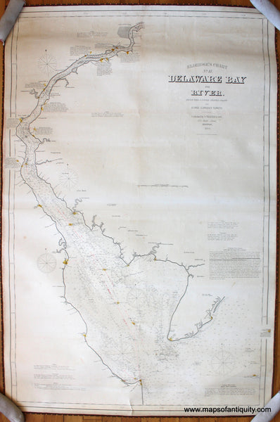
On this 1884 Chart of Delaware Bay and River, Eldridge has stripped away all unnecessary information, leaving bold coast lines, navigational information, and spots of color indicating lighthouses and lightships. At one point he was paying his daughters a small amount to color the charts.
What we call Coast Survey Report Charts are notably different from nautical charts. These were published in the US Coast Survey's annual reports- they were printed on light-weight paper and folded into the report book. Using various names through the 19th century, the United States Survey of the Coast (1807–1836), United States Coast Survey (1836–1878), and United States Coast and Geodetic Survey (USC&GS) (1878–1970), is a United States federal agency that defines and manages a national coordinate system, providing the foundation for transportation and communication; mapping and charting; and a large number of applications of science and engineering.

1854 Coast Survey report of the coast of Virginia, with modern hand coloring. With the exception of lighthouses as seen in the Eldridge chart above, charts were never colored. Color on a nautical chart, coast report chart, or harbor chart is almost certainly a modern addition. Adding color to a chart generally does not negatively affect its value, in fact if the color is done well it can make it more desirable.
Ever since it began operations, the Coast Survey had faced hostility from politicians who believed that it should complete its work and be abolished as a means of reducing U.S. Government expenditures, and Hassler and Bache, early directors of the Coast Survey, had fought back periodic attempts to cut its funding. By 1850, the Coast Survey had surveyed enough of the U.S. coastline for a long enough time to learn that – with a few exceptions, such as the rocky coast of New England – coastlines were dynamic and required return visits by Coast Surveyors to keep charts up to date. In 1858, Bache for the first time publicly stated that the Coast Survey was not a temporary organization charged with charting the coasts once, but rather a permanent one that would continually survey coastal areas as they changed over time. Also, as larger and larger ships were created, it became more important to have accurate deep water data.

This US Army Corps of Engineers chart shows the progress of work being done to the Potomac River at the coast of Washington D.C. to accompany the annual report of 1888. Coastal areas changed for many reasons, both natural and man-made.
Another significant moment in the Survey's history that occurred in 1858 was the first publication of what would later become the United States Coast Pilot, when Survey employee George Davidson adapted an article from a San Francisco, California, newspaper into an addendum to that year's Annual Report of the Superintendent of the Coast Survey. Although the Survey had previously published its work indirectly via the Blunts' American Coast Pilot, it was the first time that the Survey had published its sailing directions directly in any way other than through local newspapers.

As far back as the 1820s, Blunt was producing small books with detailed harbor charts, called a Coast Pilot. The large nautical charts allowed ships to cross vast oceans, but navigating into a harbor required carefully detailed information that was best delivered by producing focused charts for each harbor. A pilot included a detailed narrative with advice on how to use the chart to the best advantage. Above is one such chart- it shows the information available in 1827 for navigating into Cape Ann and Gloucester Harbors.

George W. Eldridge produced a similar, although larger, book of harbor charts in his unique style in the early 20th century. His books of charts were developed to assist the growing number of yachtsmen who sailed along the coast and needed safe harbors during stormy periods. This harbor chart of Greenport, Orient, and Sag Harbor on Long Island contained all the necessary information a sailor would need to navigate these waters in 1901.
Other nautical items we sell include Light House Survey Charts, produced by the US Light House Survey, documenting the locations and arc of light for each lighthouse. These were not used for navigation.

This 1896 USLHS chart covers part of the Great Lakes, showing the lighthouses around Lake Superior with parts of Lake Michigan and Lake Huron.
CLICK HERE TO EXPLORE ALL OF OUR COAST SURVEY REPORT CHARTS
CLICK HERE TO EXPLORE ALL OF OUR NAUTICAL AND HARBOR CHARTS
CLICK HERE TO EXPLORE ALL OF OUR LIGHTHOUSE CHARTS
Nautical Themed Maps
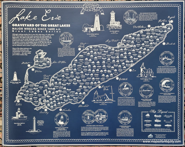
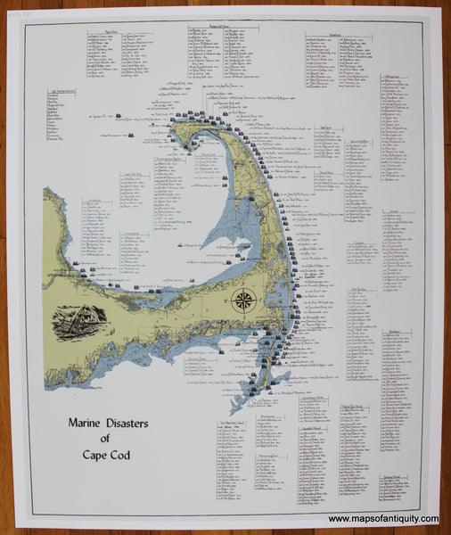
Sometimes a customer comes in and asks for a nautical map, but we soon discover that they are seeking a nautical themed map, and not a true nautical chart. This sort of map includes our popular shipwreck maps, and well as other maps that have a nautical feel or blue and white coloring.

Note: some of the information presented here was gleaned from various Wikipedia pages. This post is for informational use only.